
Kraszczady
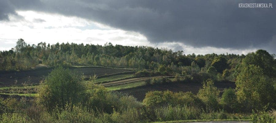
Kraszczady - a mysterious land that is hard to find on maps… Although the name clearly seems to refer to the Bieszczady mountains, in reality, Kraszczady, despite being called the "Little Bieszczady", have nothing in common with them or with the Carpathians in a scientific sense. In fact, this "land" is located in the heart of the Lublin region. Precisely indicating its location can indeed pose considerable challenges. Let's start with the "Little Bieszczady"; this term has been used for a long time by those visiting the Krasnystaw area, mainly around Gorzków, particularly the picturesque villages of Bobrowe and Olesin, as well as Orłów Drewniany and Murowany, Kryniczek, and Stryjowa, for example. These areas—located on the Lublin Upland in the mesoregions of Giełczew Uplands and Grabowiec Hills—do resemble the Bieszczady landscapes to some extent, although they are of course scaled down considerably. Centrally located between the mentioned regions is the town of Krasnystaw. This is where the term “Krasnostawskie (little) Bieszczady” originates, which has transformed into the term Kraszczady over the past few years, gradually spreading in the consciousness of the local community and a few tourists who have found themselves here under various circumstances. The name Kraszczady was coined by passionate hikers and advocates of tourism: Zbyszek Soczyński, Janek Stomma, and Stanisław Rycyk leading the way. Therefore, we know that originally Kraszczady referred to the most picturesque area of elevations covering parts of the Krasnystaw, Gorzków, and Rudnik municipalities. Today, the name is also used concerning the municipalities of Izbica, Kraśniczyn, and Żółkiewka—thus encompassing significant territories of the county. In this broad context, Kraszczady are areas with relatively high forest coverage, significantly used for agriculture, with rare development generally concentrated in clusters and a not very extensive network of paved roads. The most characteristic features are the picturesque uplands, divided by dry as well as marshy valleys, including river valleys. The elevation differences here exceed 100 meters, with the highest elevations reaching up to 300 meters above sea level. Another element of the Kraszczady landscape includes both solitary and complex systems of loess valleys—sometimes referred to as derbies, and less frequently as ditches. The deepest valleys, sometimes with slopes over 20 meters high, reach the level of chalk sedimentary rocks. These valleys were formed due to natural water erosion and at times as a result of the use of dirt roads (e.g., the mill road in the "Wodny Dół" reserve). It is worth noting that a part of the Kraszczady area is protected as the Skierbieszów Landscape Park or, for example, Protected Landscape Areas; we can also find nature reserves and Natura 2000 areas here. Kraszczady are characterized by an extremely diverse landscape, interesting fauna and flora, as well as relatively numerous historical sites located both within their boundaries and in the immediate vicinity. The scenic qualities of Kraszczady represent considerable tourism potential, especially for those weary of the crowds on the trails of the neighbouring Roztocze. These areas are perfect for hiking, cycling, horseback riding, and in winter, cross-country skiing as well. A plus, as well as a minus—depending on subjective expectations—is the small, almost negligible number of designated trails, strictly tourist infrastructure, or documentation; on one hand, this complicates tourism, but on the other hand, it results in mystery and uniqueness of the trips. In upcoming sections, we will attempt to discuss individual regions of Kraszczady, their "treasures," and also present existing and proposed trails deserving of promoting the Lublin region. Author of the photos and text: www.krasnostawska.pl Author's page - http://www.krasnostawska.pl/tajemnicze-kraszczady/

")
")
")
")

")
")