
Responsible Tourism [#09] - apps useful during mountain trips
![Responsible Tourism [#09] - apps useful during mountain trips](/images/Polska_Podroznicza/PP_43/316741298_593594822531893_7683292080591518_n.jpg)
We increasingly cannot imagine our daily lives without a phone or the Internet. They often assist us in very simple situations, replacing books, television, radio, or face-to-face meetings with friends. However, it is worth mentioning the great utility of a phone during mountain expeditions. Of course, it cannot replace a good old paper map, but it can often make things easier and sometimes even save lives. Especially since each of us always has it in our pocket. Below is a list of applications that every responsible tourist should have on their phone.
1. Life-saving applications:
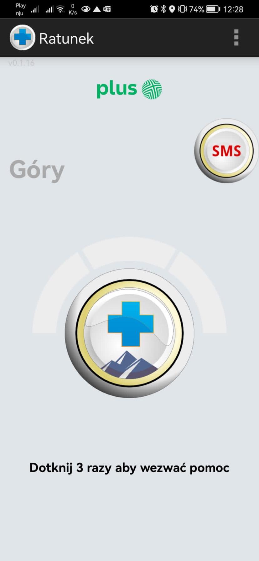
Rescue – an application that makes it easy to report an accident and every tourist should have it. It is very simple to use. If you need to call for help, it allows you to send your location. Thanks to this app, rescuers from TOPR and GOPR will know exactly where to go to assist you quickly and efficiently.
Mountain Rescue Service – if you're heading to the Slovak part of the Tatra Mountains, this application must be on your phone. It allows us to call the emergency number of the Slovak Mountain Rescue Service and send an emergency message that automatically includes our current GPS position. It is worth remembering that in Slovakia, we are required to purchase insurance if we venture into the Tatras.
2. Weather applications:
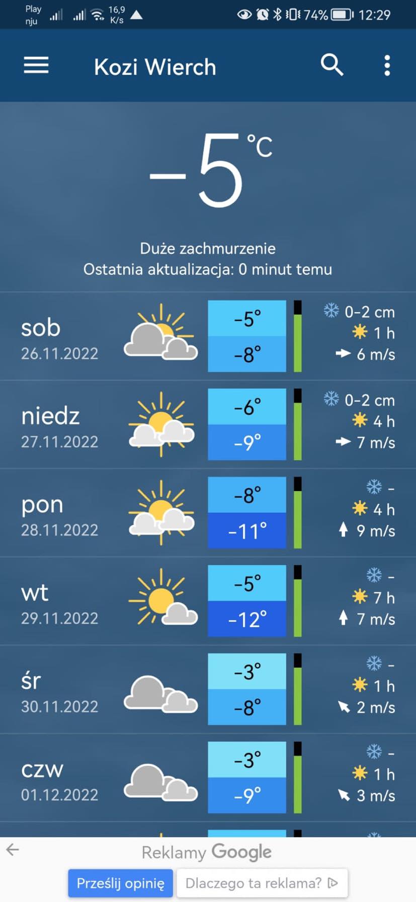
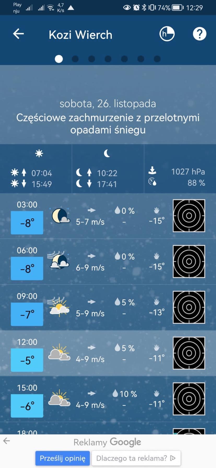
Meteoblue – a very user-friendly application that allows us to precisely determine the weather for our current location. The forecast covers 7 days, and there is also a 14-day option available. For each day, we can see the percentage probability of the forecast. The app also allows us to search for mountain peak names, which is very useful when planning trips.
Blitzortung – this app is a great thunderstorm radar. Real-time information about ongoing storms is overlaid on the map. We can recognize how much time has passed since the last lightning strike by its colour.
3. Maps:
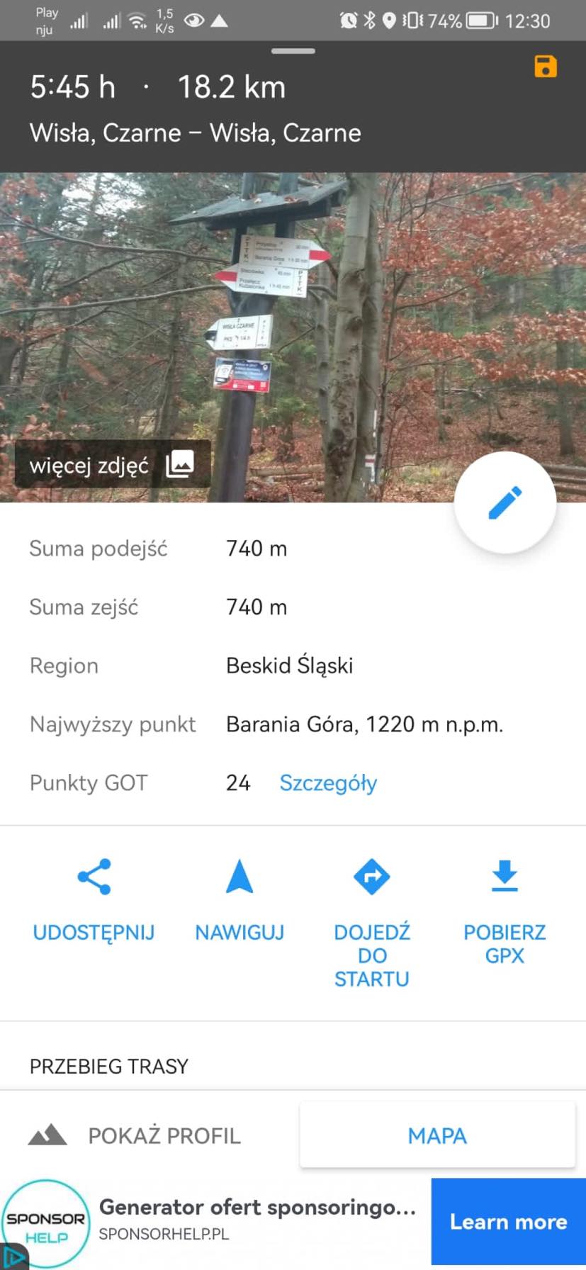
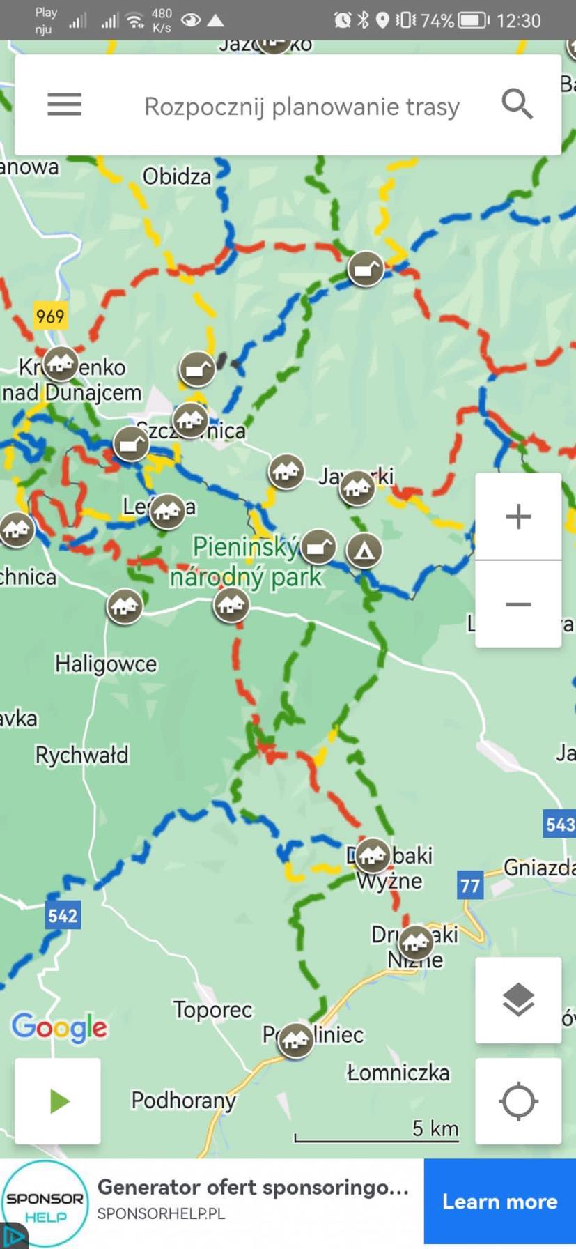
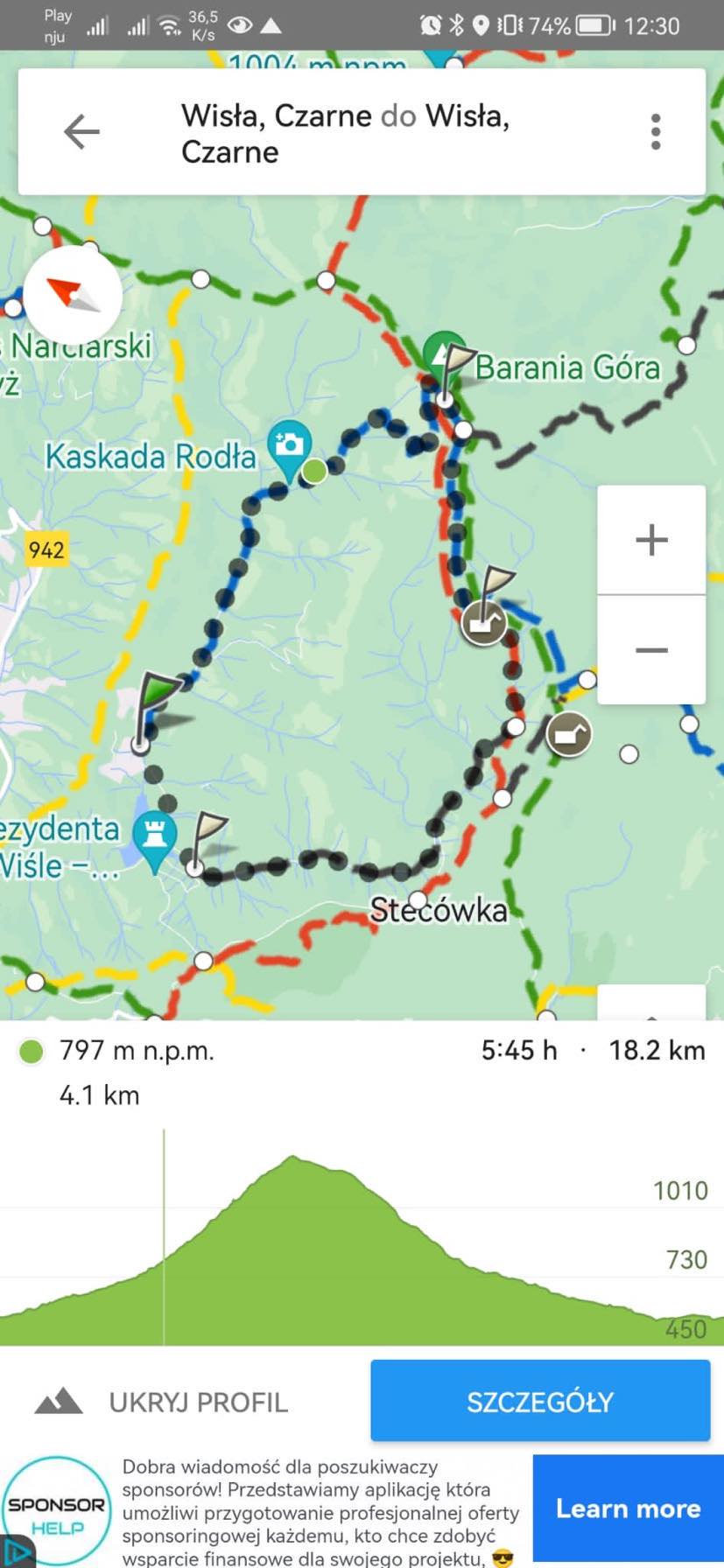
Tourist Map – a favourite among maps that greatly facilitates route planning. By sequentially mapping points we want to pass through, we can see the course of our route, how much time it should take us, how many kilometers we will walk, how much elevation we will gain, and what the altitude profile looks like. Additionally, we can see information about GOT points. It is available in both paid and free versions, with the former allowing offline use.
Mapy.cz – an application that has very detailed maps, showing even the smallest paths, shelters, and huts. Most importantly, it works offline.
4. Curiosities:
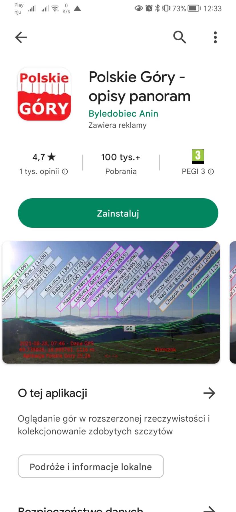
Polish Mountains – this app allows us to identify the peaks in front of us. If we point our phone towards the horizon, we will see labels for all the peaks that the app has managed to recognize. Note! To use it, we need to have the internet and GPS enabled.
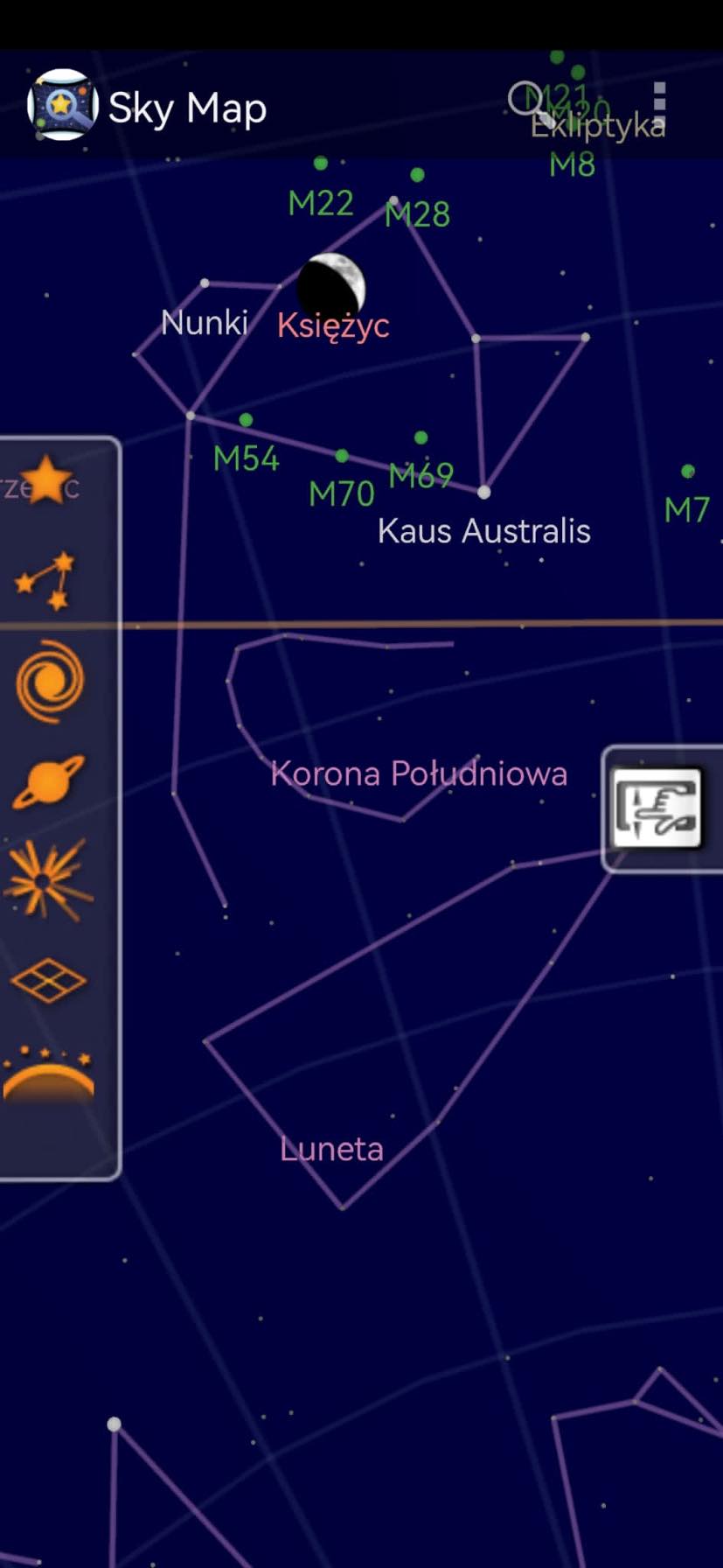
Sky Map – an application particularly useful at night. It allows us to view a real-time map of the stars. By looking at the phone screen directed towards the sky, we can see the stars, planets in the Solar System, and specific constellations.
Photo and text author: Ewa Bandyk


")
")
")
")

")
")